Here's the latest from the National Weather Service for my area. If this doesn't sound like fun, well then I don't know what does! (sarcasm there folks)
Severe weather alert from the national weather service
...hurricane charley local statement national weather service tampa bay area - ruskin fl 301 pm edt thu aug 12 2004
... Intensifying hurricane charley may be a dangerous threat to the suncoast friday... ... Hurricane warnings likely to be issued by 5 pm today...
... The hurricane watch continues for the following areas:
Charlotte citrus de soto hernando hillsborough lee levy manatee pasco pinellas sarasota
Including... The coastal waters from bonita beach to suwanee river... Charlotte harbor... And tampa bay.
... Storm location... At 2 pm edt... The center of hurricane charley was located near 20.4 north... 81.5 west... Or about 515 miles south of tampa. Charley was moving to the northwest at 17 mph... And is expected to continue to move at around this speed while gradually turn to the north northwest over the next 12 to 18 hours. Maximum sustained winds have increased to 105 mph... And additional strengthening is expected as the storm moves out of the caribbean and into the gulf. Minimum central pressure was 980 mb... 28.94 inches.
... Storm surge flood and storm tide impacts... With charley expected to intensify... Then accelerate... Along the suncoast... The threat of a rapidly developing storm surge in the storm's southern semicircle is great. Current indications suggest the highest surge will occur from the counties near tampa bay south to lee county. The current forecast track... Speed... And intensity suggest storm surges in some areas equalling or exceeding those experienced in hurricane donna in 1960 and the 1944 hurricane each of which made landfall north of fort myers... Or more likely the 1921 hurricane which made landfall in northern pinellas county.
The exact location and strength of the surge should become more clear later today. For now... All coastal residents should be rushing to completion any last minute preparations this afternoon since a warning will issued this afternoon.
In short... A surge of 10 or more feet is possible in the southern semicircle of the storm just after landfall. Flooding may be highly dependent on the time and value of high tides on friday.
... Wind impacts... Charley is forecast to intensify to a strong category two hurricane as it approaches the suncoast on friday... With winds in the inner eyewall perhaps at least 110 mph with higher gusts. However... No matter where the center crosses... Current forecast data suggest tropical storm force winds of at least 40 mph will affect all areas of west central and southwest florida between friday morning and friday evening.
Details on specific damage impacts will be provided after hurricane warnings are issued after 5 pm today.
... Rainfall... Rainfall totals of at least 3 to 6 inches are likely beginning late tonight and continuing through friday night. In all areas... These rains will cause significant rises in rivers... Creeks... And streams. However... In areas near tampa bay where some rivers are in flood and all rivers are running high... Moderate to major flooding is possible during and after the passage of charley.
Flood watches have been issued for all of west central and southwest florida.
... Tornado impacts... A tornado watch is in effect until 9 pm this evening for areas east and north of tampa bay. This watch is largely independent of hurricane charley and related to teh interaction between tropical storm bonnie... Now decaying while racing toward the georgia coast... And deepening southerly flow around a building ridge off the atlantic coast.
There is a risk of tornadoes late tonight through friday evening from the outer rainbands of charley... Especially 50 miles or more away from the center of circulation. Tornadoes would be most likely beginning Friday and continuing into friday night well east and southeast of the center.
The next hurricane local statement from the tampa bay area forecast office will be issued around 6 pm today.
I'll keep up with the updates as long as power and cable and conditions permit. Right now it's breezy outside and there's some clouds in the sky. It's not overly sunny but it's not dark either. Actually, I take that back; it is getting a bit dark out there. Not exceptionally dark or anything, it gets darker then this on afternoon showers, but still. Here's a peek:
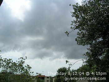
Thursday, August 12th 2004 @ 4:15pm
We should get more menacing reports after 6pm. Joy!
~ flowers bloom near Memory and Dream
at 8/12/2004 04:06:51 PM ~
~
![]()
